715-254-1636
Images of America At-A-Glance Answers Products Schedule Of Events Request our Brochure
Photo Mug Masterpiece Oil Deck Of Cards Backlit Transparency Airware
Sales

View your Montana Aerial Photography right here on our site. NEW IN 2020

When you finish signing up for new custom photography, select View Proofs Online from the main menu.
Our entire historical database from 1991 to 2023 is now available in 2024.


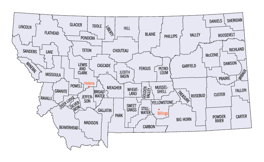
To continue with your new photography request, select your County.

By signing up for new photography and making a qualifying purchace, you will be given FREE access to your previous photography of the same location.


Montana Counties

Montana County Selection Map

Lincoln CountySheridan CountyDaniels CountyFlathead CountyGlacier CountyValley County Phillips CountyToole CountyBlaine CountyLiberty CountyHill CountyRoosevelt CountyPondera CountySanders CountyChouteau CountyRichland CountyMcCone CountyTeton CountyLake CountyGarfield CountyLewis and Clark CountyDawson CountyFergus CountyCascade CountyMissoula CountyPowell CountyMineral CountyPetroleum CountyWibaux CountyJudith Basin CountyPrairie CountyMeagher CountyCuster CountyRosebud CountyGranite CountyFallon CountyBroadwater CountyMusselshell CountyGolden Valley CountyWheatland CountyRavalli CountyJefferson CountyYellowstone CountyTreasure CountyDeer Lodge CountyCarter CountySweet Grass CountySilver Bow CountyGallatin CountyPark CountyStillwater CountyBig Horn CountyBeaverhead CountyPowder River CountyMadison CountyCarbon CountyCarbon County Montana map